


Voting District 209, Garfield County, Oklahoma
About
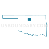
Outline

Summary
| Unique Area Identifier | 653994 |
| Name | Voting District 209 |
| County | Garfield County |
| State | Oklahoma |
| Area (square miles) | 112.61 |
| Land Area (square miles) | 112.32 |
| Water Area (square miles) | 0.29 |
| % of Land Area | 99.74 |
| % of Water Area | 0.26 |
| Latitude of the Internal Point | 36.54205830 |
| Longtitude of the Internal Point | -97.61338800 |
Maps


Graphs
Select a template below for downloading or customizing gragh for Voting District 209, Garfield County, Oklahoma


Neighbors
Neighoring Voting District (by Name) Neighboring Voting District on the Map
- Voting District 103, Noble County, OK
- Voting District 210, Garfield County, OK
- Voting District 211, Garfield County, OK
- Voting District 212, Garfield County, OK
- Voting District 23, Grant County, OK
- Voting District 26, Grant County, OK
- Voting District 417, Kay County, OK
Top 10 Neighboring County Subdivision (by Population) Neighboring County Subdivision on the Map
- Tonkawa CCD, Kay County, OK (3,978)
- North Garfield CCD, Garfield County, OK (3,398)
- Southwest Grant CCD, Grant County, OK (1,475)
- Lamont CCD, Grant County, OK (860)
- Billings CCD, Noble County, OK (724)
Top 10 Neighboring Place (by Population) Neighboring Place on the Map
Top 10 Neighboring Unified School District (by Population) Neighboring Unified School District on the Map
- Garber Public Schools, OK (1,788)
- Pond Creek-Hunter Schools, OK (1,410)
- Kremlin-Hillsdale Schools, OK (1,345)
- Deer Creek-Lamont Schools, OK (1,009)
- Billings Public Schools, OK (815)
Top 10 Neighboring State Legislative District Lower Chamber (by Population) Neighboring State Legislative District Lower Chamber on the Map
Top 10 Neighboring State Legislative District Upper Chamber (by Population) Neighboring State Legislative District Upper Chamber on the Map
Top 10 Neighboring 111th Congressional District (by Population) Neighboring 111th Congressional District on the Map
Top 10 Neighboring Census Tract (by Population) Neighboring Census Tract on the Map
- Census Tract 11, Kay County, OK (3,978)
- Census Tract 11, Garfield County, OK (3,398)
- Census Tract 9565, Grant County, OK (3,052)
- Census Tract 9571, Noble County, OK (2,860)
- Census Tract 9564, Grant County, OK (1,475)
Top 10 Neighboring 5-Digit ZIP Code Tabulation Area (by Population) Neighboring 5-Digit ZIP Code Tabulation Area on the Map
- 73701, OK (24,808)
- 74653, OK (3,892)
- 73738, OK (1,134)
- 73766, OK (1,096)
- 74630, OK (702)
- 74643, OK (615)
- 73753, OK (468)
- 74640, OK (312)